What is Nagarkot?
Nagarkot is a hill village and viewpoint on the eastern rim of the Kathmandu Valley. Most sources place it in Bhaktapur District, and Republica describes it as lying on the border between Bhaktapur and Kavre.
The Nepal Tourism Board calls it a small hilly settlement that’s popular with locals and tourists. It’s also a weekend break for Kathmandu residents, so hotels and viewpoints can fill up.
How high is Nagarkot, and how far is it from Thamel?
Nagarkot is a little under 2,200 metres high and about 32 km from Kathmandu by road. The exact figures vary between sources.
| Measure | Figure | Source |
|---|---|---|
| Height | 2,175 m | Nepal Tourism Board, In Your Pocket, Wikipedia’s fact box |
| Height | 2,195 m | Wikipedia’s text, Nepal Traveller, Hop Nepal |
| Road distance | 32 km | Nepal Tourism Board sunrise page, In Your Pocket, The Longest Way Home |
| Road distance | 30 km | Nepal Tourism Board hill stations page |
| Road distance | 27 to 27.8 km | Hop Nepal and Nepal Traveller, which also give 32 km |
| Drive time | 30 to 45 minutes | Nepal Tourism Board |
| Drive time | About 1.5 hours | In Your Pocket, Hop Nepal |
| Drive time | About 2 hours | Nepal Traveller |
| Taxi time | 2 to 2.5 hours | The Longest Way Home |
The 30 to 45 minutes looks too short beside every other source, so plan on at least 1.5 hours. By our own map measurement, it’s 20.5 km in a straight line from Thamel.


What is the history of Nagarkot?
Nagarkot began as a fort, according to Wikipedia, built to watch the activities of other kingdoms. It later became a summer retreat for the royal family, and then a hill station for international visitors. Wikipedia gives no dates for these changes, and we couldn’t find them elsewhere.
Who lives at Nagarkot?
About 5,234 people lived here in 1,084 houses at the 2021 census, according to Wikipedia. City Population lists the ward at 4,247 people in 2001 and 4,571 in 2011. We couldn’t find a reliable account of its communities, so we don’t describe them.


What can you see from Nagarkot?
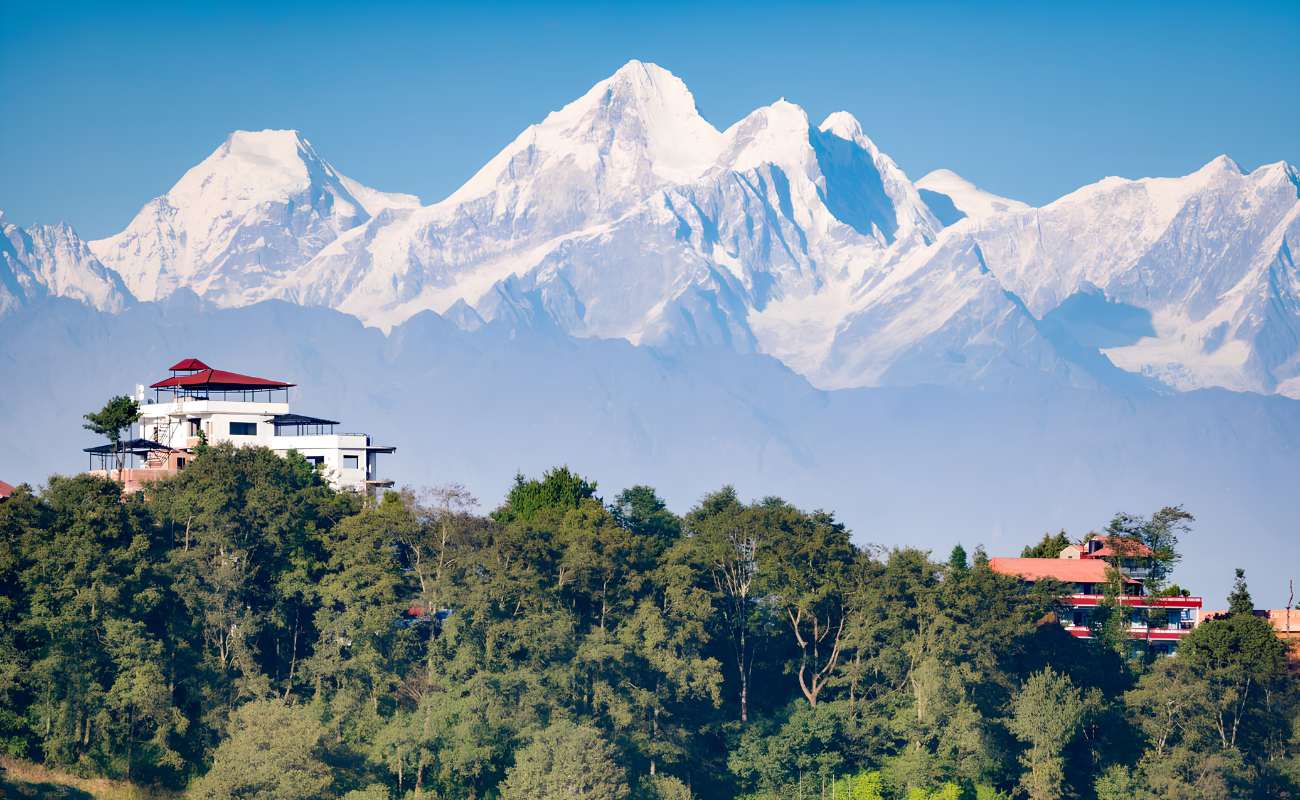
You can see a long stretch of the Himalaya and the valley below on a clear day, and sometimes very little. Sources count the view differently.
- The Nepal Tourism Board: Five of the world’s 10 tallest peaks, naming Everest, Lhotse, Cho Oyu, Makalu and Manaslu.
- Wikipedia: Eight of Nepal’s 13 Himalayan ranges, including Annapurna, Manaslu, Ganesh Himal, Langtang and the Everest range.
- The Longest Way Home: Ganesh Himal, Langtang Lirung, Shisha Pangma, Dorje Lakpa and Gauri Shankar, with Dhaulagiri to the west and Kanchenjunga to the east.
The Longest Way Home says to expect Everest as “more of a dot than an eyeful”. If you’ve already trekked in the Annapurna or Everest regions, it says you won’t get views as good as those.
Local officials were far less hopeful in December 2024. Republica quoted a Changunarayan ward chairman saying that smoke, dust, pollution and climate change stop sunrise and sunset being seen clearly. The mayor said it’s better not to attract tourists through false expectations. The Longest Way Home still said in October 2026 that clear views are possible from October to February.
To weigh it against the valley’s other high point, read Nagarkot or Chandragiri.
What else is there to do at Nagarkot?
Walking is the main activity besides the view. Bhaktapur.com and Nepal Traveller name these places. We haven’t confirmed that each one is open.
- Nagarkot View Tower: A viewing platform reached by stairs through forest. The Longest Way Home describes a 4 km walk of 1 to 2 hours to it, and says it gets crowded with tour groups in peak season.
- Buddha Peace Park: A park with a Buddha statue, near the Nagarkot Buddhist Monastery.
- Mahakali shrine: A shrine that Bhaktapur.com says has a view of the Langtang range.
- Telkot: A small village between Nagarkot and Changu Narayan.
- Muhan Pokhari: A pond and waterfall area, listed by Bhaktapur.com.
Horse riding and mountain bikes are offered through hotels and agents, according to The Longest Way Home, though bikes aren’t always available. Wikipedia and Nepal Traveller also mention paragliding. We couldn’t confirm a current operator.
Food is limited. The Longest Way Home says independent restaurants are in short supply outside the hotels.


What did the 2015 earthquake do to Nagarkot?
The 25 April 2015 earthquake badly hit Nagarkot’s hotels, though early reports differ on how badly. Both reports quote the same local tourism committee chairman.
- May 2015, Republica: Most hotels and resorts had been levelled. The chairman said 12 big hotels were razed, and seven more were left uninhabitable.
- 12 June 2015, ShareSansar: More than 60 big hotels and 150 restaurants were affected. More than a dozen hotels were running again after minor repairs, some since 15 May, and visitor numbers were at 10 to 15% of normal.
We found no later survey of the rebuilding. The Longest Way Home said in October 2026 that there’s no shortage of accommodation.
What is the best time to visit Nagarkot?
October and November give the highest odds of clear skies, according to In Your Pocket. Other sources stretch that window, so no one can promise a good morning.
| Months | What sources say |
|---|---|
| October to February | Clear views possible (The Longest Way Home) |
| March to May | The Longest Way Home lists this for clear skies, but also calls the hot season hazy |
| Late winter | Hazy weeks are a gamble (In Your Pocket) |
| June to September | A gamble (In Your Pocket), and near permanently cloudy (The Longest Way Home) |
Nagarkot sunrise time ranges from about 5 am in June to about 6:48 am in January, according to Sunrisesunset.io’s figures for the village. It gives 4:59 am on 15 June, 5:32 am on 15 April, 5:56 am on 15 October, 6:16 am on 15 November and 6:48 am on 15 January, with first light about 25 minutes earlier. Solarwatch’s monthly times for Kathmandu run about 8 to 10 minutes later. To arrive by sunrise with the 1.5 to 2 hour drive most sources give, you’d leave Kathmandu at about 3 to 3:30 am in June and 4:15 to 4:45 am in mid-November, by our own arithmetic.
Morning and evening are the best times of day, according to The Longest Way Home. Our guide to the best time to visit Kathmandu has the wider picture.

What can go wrong at Nagarkot?
Cloud is the main risk, and you can drive all that way and see nothing. Decide before you go whether that’s acceptable.
- Monsoon roads: The UK Foreign Office says the monsoon normally runs from June to October, and that flooding and landslides can make roads impassable.
- Getting back: Hop Nepal says there’s no taxi stand at Nagarkot, so arrange your return before you go.
- Buses: The UK Foreign Office says bus accidents are common in Nepal. Hop Nepal calls the Bhaktapur bus route long and inconvenient.
- A surprise fee: The Longest Way Home reports an unofficial charge of about NPR 340 near the bus stop, collected on and off. The Nepal Tourism Board denounced it when it began in 2017, the same guide says. Changunarayan’s mayor said in December 2024 that the municipality’s fee had been cancelled.
- Crowds: Weekends in peak season are often full of local visitors and tourists.
How should you behave at Nagarkot?
Treat the shrines and the monastery as places of worship. The UK Foreign Office advises avoiding shorts and sleeveless tops in holy places, and taking off your shoes where that’s expected.
Ask before you take photos of people. Nagarkot is also where people live and work, so keep to the paths when you walk through farmland and villages.

How do you get to Nagarkot on your own?
A taxi or hired car from Kathmandu is the simplest way, and buses go via Bhaktapur. Prices below come from guides and may have changed, so check them.
- Taxi from Kathmandu: Up to NPR 3,000 and 2 to 2.5 hours, according to The Longest Way Home, as of October 2026. It suggests booking the return through your hotel.
- Private car for the day: NPR 4,000 to 6,000, according to In Your Pocket (undated).
- Bus from Kathmandu: 2.5 to 3 hours with a change at Bhaktapur, according to The Longest Way Home. In Your Pocket says the first bus won’t arrive in time for sunrise.
- Bus from Bhaktapur: About 1 hour and NPR 50, from a small terminal near Kamal Pokhari, according to The Longest Way Home.
- Taxi from Bhaktapur: 45 minutes to 1 hour, and NPR 800 to over 1,000 after bargaining, according to the same guide.
Our Kathmandu taxi fare guide covers city prices.
What is near Nagarkot?
Changu Narayan and Bhaktapur are the two closest major sights. By our own map measurement, they’re about 9 km and 10 km away in a straight line.
Many people walk the ridge down to Changu Narayan, and the Nepal Tourism Board describes views of Sankhu to one side and Bhaktapur to the other. In Your Pocket gives 3 to 4 hours for the walk, while our tour page allows 4 to 5 hours. See our Changu Narayan guide and Bhaktapur Durbar Square guide.
The Nepal Tourism Board also mentions a trail south to Nala and Banepa. The Longest Way Home suggests Dhulikhel as a quieter alternative for views.

Should you visit Nagarkot with a guide or alone?
You can visit alone, and The Longest Way Home says it’s easy without a tour by bus or taxi. The hard part is sunrise, because public buses don’t get you there in time. You’d need a pre-arranged car, or a night at a hotel.
A guide helps most on the walks. Full Time Explorer, writing in 2020, found the walk from Bhaktapur through Changu Narayan to Nagarkot confusing in places, with an unsigned turn and few tea stops. Three of our tours stop here. The Nagarkot sunrise and Bhaktapur tour adds an old city on the way home, and the Changu Narayan hike walks the ridge.